Dead Sea
Lowest land elevation on Earth, deepest hypersaline lake, 9.6 times saltier than the ocean.

Hoshvilim · CC BY-SA 4.0
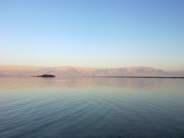
The Dead Sea is a landlocked salt lake bordered by Jordan to the east, the West Bank to the west, and Israel to the southwest. It lies in the endorheic basin of the Jordan Rift Valley, and its main tributary is the Jordan River. As of 2025, the lake's surface is 439.78 metres (1,443 ft) below sea level, making its shores the lowest land-based elevation on Earth. It is 304 m (997 ft) deep, the deepest hypersaline lake in the world. With a salinity of 342 g/kg, or 34.2% (in 2011), it is one of the world's saltiest bodies of water, 9.6 times as salty as the ocean—and has a density of 1.24 kg/litre, which makes swimming similar to floating. This salinity makes for a harsh environment in which plants and animals cannot flourish, hence its name.
- maximum_depth
- 304 m (997 ft)
- surface_area
- 605 km2 (234 sq mi)
Verified Timeline
Lore & Background
The Dead Sea has attracted visitors from around the Mediterranean basin for thousands of years. It was one of the world's first health resorts, and it has been the supplier of a wide variety of products, from asphalt for Egyptian mummification to potash for fertilisers. Today, tourists visit the sea on its Israeli, Jordanian and West Bank coastlines. The Dead Sea is receding at a swift rate; its surface area today is 605 km2 (234 sq mi), having been 1,050 km2 (410 sq mi) in 1930. Multiple canal and pipeline proposals, such as the scrapped Red Sea–Dead Sea Water Conveyance project, have been made to reduce its recession.
Reader's Guide
The Dead Sea's main, northern basin is 50 kilometres (31 mi) long and 15 kilometres (9 mi) wide at its widest point. It is fed by several sources including the Jordan River, the Arava Stream, Wadi Mujib, Wadi Darga, Wadi al-Hasa, Nahal Arugot, Wadi Wala, Wadi Zarqa Ma'in, Nahal Tur, Nahal Og, groundwater seepage, and direct rainfall. The Jordan River currently only contributes about one-sixth of the inflow to the Dead Sea, less than direct rainfall. Rainfall is scarcely 100 mm (4 in) per year in the northern part and barely 50 mm (2 in) in the southern part. The Dead Sea zone's aridity is due to the rainshadow effect of the Judaean Mountains. To the west, the Judaean mountains rise less steeply and are much lower than the mountains to the east. Along the southwestern side of the lake is a 210 m (700 ft) tall halite mineral formation called Mount Sodom.
Did You Know?
- The Dead Sea's salinity is 342 g/kg, or 34.2% (in 2011), making it 9.6 times as salty as the ocean.
- Its density of 1.24 kg/litre makes swimming similar to floating.
- The Dead Sea's surface area has shrunk from 1,050 km2 in 1930 to 605 km2 today.
- The lake is 304 m (997 ft) deep, the deepest hypersaline lake in the world.
- Along the southwestern side of the lake is a 210 m (700 ft) tall halite mineral formation called Mount Sodom.
Physical Geography & Extreme Conditions
The Dead Sea occupies the Jordan Rift Valley, a tectonic feature carved by the Dead Sea Transform where the African and Arabian plates slide past one another. This landlocked salt lake sits at the lowest point on Earth's land surface, with its 2025 water level measured at 439.78 metres below sea level. Stretching roughly 50 kilometres in length and 15 kilometres at its widest in the northern basin, the lake plunges to a depth of 304 metres, making it the deepest hypersaline body of water on the planet. Its salinity, recorded at 34.2 percent in 2011, is nearly ten times that of the open ocean, giving the water a density of 1.24 kilograms per litre that turns swimming into something closer to floating. The surrounding climate is brutally dry, shaped by the rainshadow cast by the Judaean Mountains to the west; annual rainfall barely reaches 100 millimetres in the north and drops to around 50 in the south. Along the southwestern shore, a 210-metre column of halite known as Mount Sodom rises from the basin floor, a geological reminder of the lake's mineral wealth.
A Lake of Many Names
No single name has ever settled the Dead Sea's identity across the ancient and modern world. In Hebrew, the oldest and most persistent designation is Yam HamMelaḥ, the Sea of Salt, a title that runs through both biblical and contemporary usage. The Talmud adds the Sea of Sodom to the lexicon, while other scriptural references include the Sea of Arabah and the Eastern Sea. Arabic speakers most commonly call it al-Bahr al-Mayyit, the Dead Sea, though the Sea of Lot—named for Abraham's nephew whose wife was transformed into a pillar of salt during the destruction of Sodom and Gomorrah—carries deep religious resonance. The Sea of Zoara, after a once-important shoreline city, appears less frequently. In the ancient Greek and Roman world, the lake was overwhelmingly identified by its bitumen: Asphalt Lake or Asphalt Sea, reflecting the enormous trade in the naturally occurring free-floating tar that washed up on its shores. Tacitus, writing in the second century, used the Latin Iudaicum mare, the Jewish Sea, while the Greek Nekrá Thálassa and Latin Mare Mortuum gave us the English calque we use today.
Ancient Trade & the Birth of the Health Resort
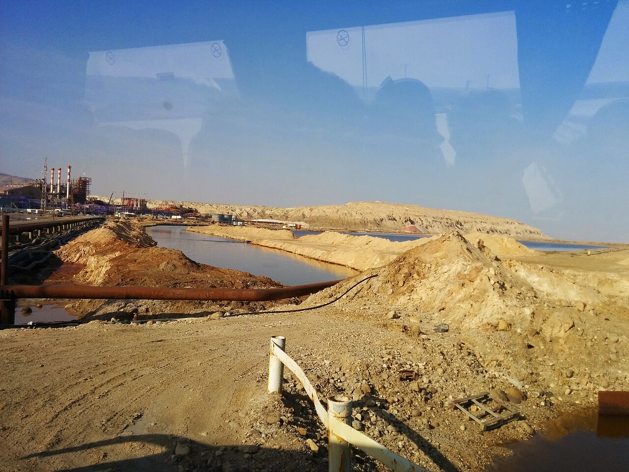
For millennia, the shores of this hypersaline basin have drawn people seeking both commerce and healing. The lake's naturally occurring free-floating bitumen was so abundant that it became a major commodity in ancient Mediterranean trade, earning the body of water its Greek and Roman identity as the Asphalt Lake. Egyptian mummifiers relied on the asphalt harvested here, while the mineral-rich waters and mud supported one of the earliest known health resorts in the world. Potash extracted from the lake later became a critical ingredient in modern fertilisers, extending the Dead Sea's economic role from antiquity into the industrial age. Small perennial springs dotting the shoreline create pools and quicksand pits that have long marked the lake's edges, and the Wadi Mujib valley to the south, sitting 420 metres below sea level, has been designated a biosphere reserve spanning 212 square kilometres. Today, visitors still flock to the Israeli, Jordanian, and West Bank coastlines, continuing a tradition of bathing and tourism that stretches back thousands of years across the entire Mediterranean basin.
The Shrinking Sea & the Fight to Save It
The Dead Sea is an endorheic lake with no outlet, meaning every drop of water that enters must leave through evaporation. That balance is now catastrophically broken. In 1930 the lake covered roughly 1,050 square kilometres; by 2025 its surface area has collapsed to about 605 square kilometres, a loss of nearly half its extent in under a century. The primary culprit is the diversion of the Jordan River, which once fed the lake from the north but now contributes only about one-sixth of total inflow—less than direct rainfall. The Wadi Hassa on Jordan's side is now entirely consumed before it reaches the basin, and the numerous smaller wadis and nahals that once trickled in from the Karak, Tafilah, and West Bank governorates face similar pressures. Multiple engineering proposals have been floated to reverse the decline, including canal and pipeline schemes that would channel water from the Red Sea. The most ambitious of these, the Red Sea–Dead Sea Water Conveyance project, was ultimately scrapped, leaving the lake to continue its rapid retreat into the Rift Valley floor.
Gallery
Frequently Asked Questions
Who is Dead Sea?
Dead Sea is a landlocked salt lake sitting in the Jordan Rift Valley, bordered by Jordan to the east, the West Bank to the west, and Israel to the southwest. It occupies an endorheic basin, so no outflowing river carries its water away.
What are Dead Sea's powers or unique traits?
Dead Sea is one of the deepest hypersaline lakes on Earth, plunging to 298 meters at its deepest point. Its salinity of 342 g/kg makes it roughly 9.6 times saltier than the open ocean, creating a habitat where virtually no plants or animals can survive.
How low does Dead Sea sit on the map?
As of 2025, its surface rests around 430 to 437 meters below sea level, making its shoreline the lowest land-based elevation anywhere on the planet.
What feeds Dead Sea?
The Jordan River is its principal tributary, delivering the bulk of the water that enters the basin. Because the lake is landlocked and surrounded by arid terrain, evaporation steadily outpaces that inflow, causing the water level to shrink over time.
Why is Dead Sea important to the wider world?
Its record-low elevation and extreme hypersalinity make it a one-of-a-kind geological and scientific landmark. It also forms a natural boundary among three political territories, giving it lasting geopolitical significance.
More in Rivers And Seas Of The World 25-27
Elsewhere in the Rivers And Seas Of The World universe
Spotted an error? Know more?
This is a living reference — every entry is fact-audited, and reader corrections feed straight into our audit queue. Suggest an edit · See this site's audit record