Colorado River
Major river of the southwestern U.S. and northern Mexico.

Agnieszka Kwiecień, Nova · CC BY-SA 4.0
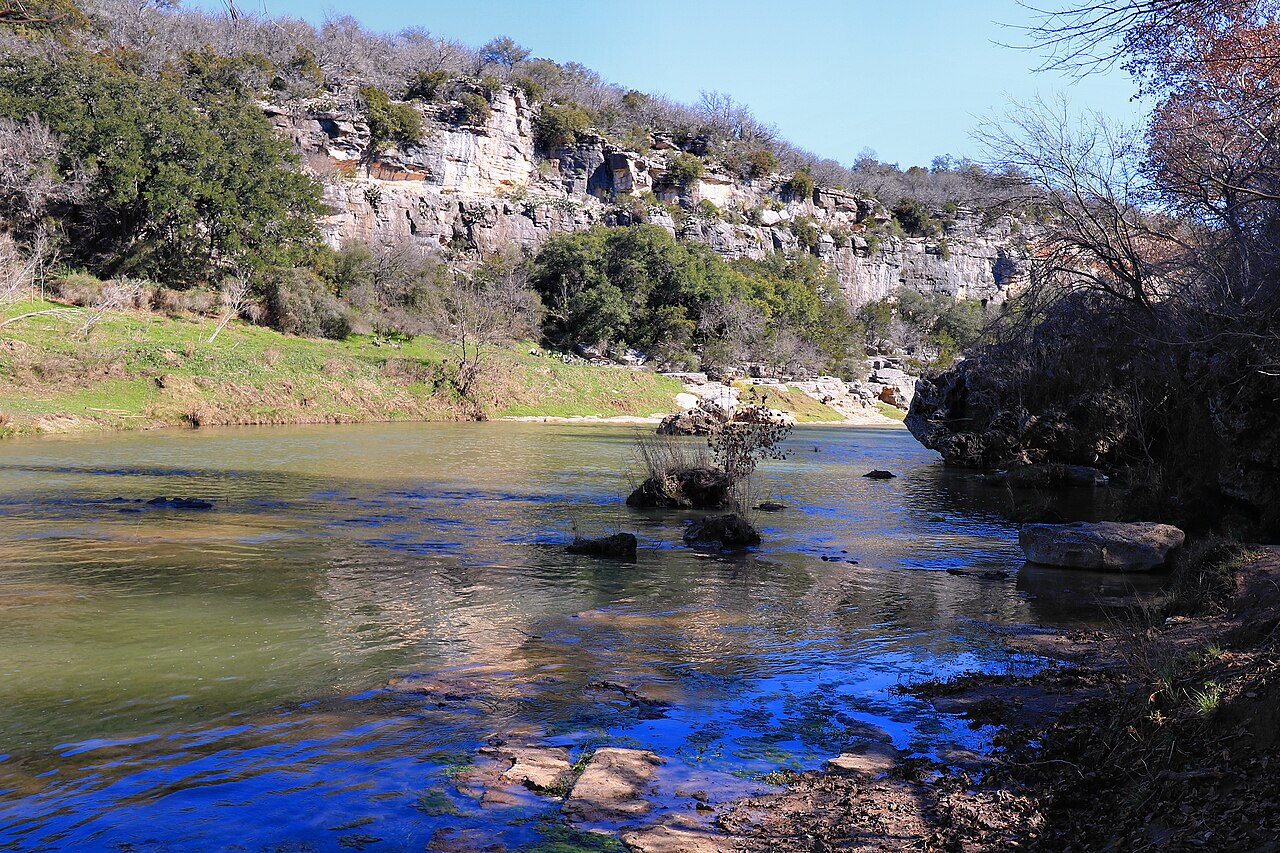
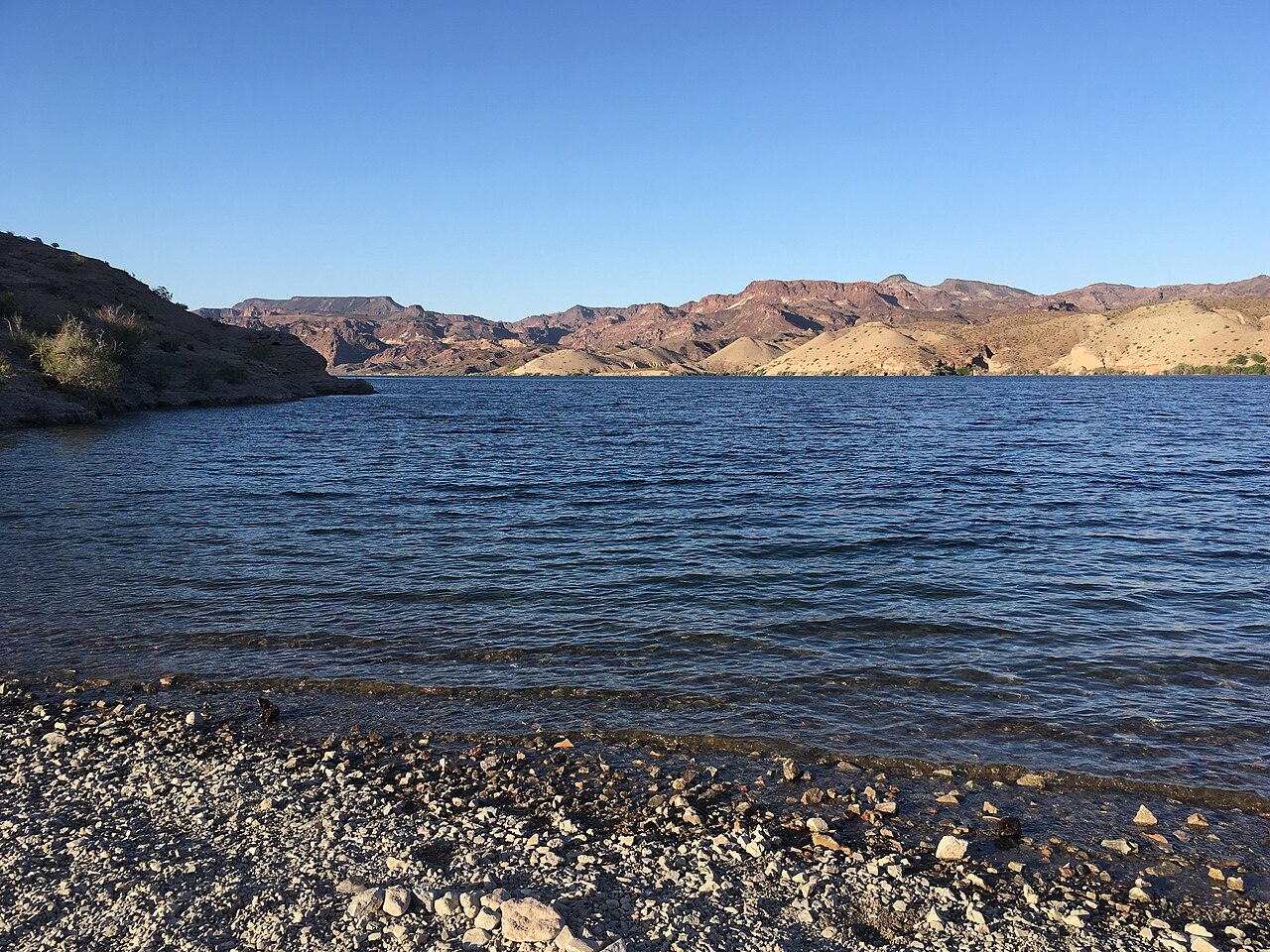
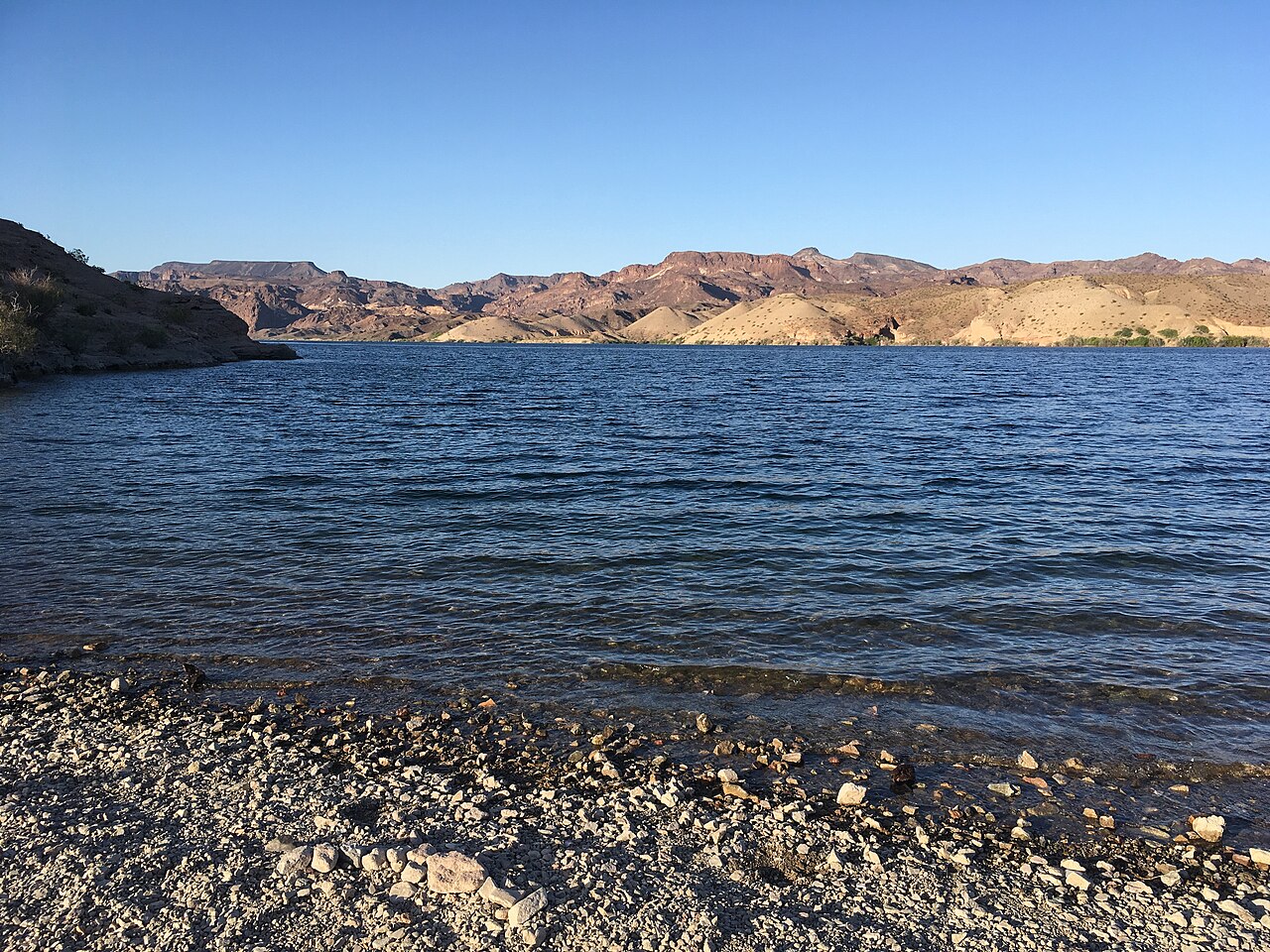
The Colorado River (Spanish: Río Colorado) is one of the principal rivers (along with the Rio Grande) in the Southwestern United States and in northern Mexico. The 1,450-mile-long (2,330 km) river, the 5th longest in the United States, drains an expansive, arid watershed that encompasses parts of seven U.S. states and two Mexican states. The name Colorado derives from the Spanish language for "colored reddish" due to its heavy silt load. Starting in the Rocky Mountains of Colorado, it flows generally southwest across the Colorado Plateau and through the Grand Canyon before reaching Lake Mead on the Arizona–Nevada border, where it turns south toward the international border. After entering Mexico, the Colorado approaches the mostly dry Colorado River Delta at the tip of the Gulf of California between Baja California and Sonora.
- length
- 1,450 miles (2,330 km)
- source
- Rocky Mountains of Colorado
- mouth
- Colorado River Delta at the tip of the Gulf of California
- major_tributaries
- Green River, Gunnison River, Dolores River, San Juan River, Little Colorado Rive
- major_dam
- Hoover Dam (completed 1935)
- largest_reservoir
- Lake Mead
- name_origin
- Spanish for 'colored reddish' due to heavy silt load
Verified Timeline
Lore & Background
Native Americans have inhabited the Colorado River basin for at least 8,000 years. Starting around 1 CE, large agriculture-based societies were established, but a combination of drought and poor land use practices led to their collapse in the 1300s. Their descendants include tribes such as the Puebloans, while others including the Navajo settled in the Colorado Basin after the 1000s. In the 1500s, Spanish explorers began mapping and claiming the watershed, which became part of Mexico upon winning its independence from Spain in 1821. Even after most of the watershed became US territory in 1846, much of the river's course remained unknown. Several expeditions charted the Colorado in the mid-19th century—one of which, led by John Wesley Powell, was the first to run the rapids of the Grand Canyon. Large-scale settlement of the lower basin began in the mid- to late-1800s, with steamboats sailing from the Gulf of California to landings along the river that linked to wagon roads to the interior. Starting in the 1860s, gold and silver strikes drew prospectors to the upper Colorado River basin.
Reader's Guide
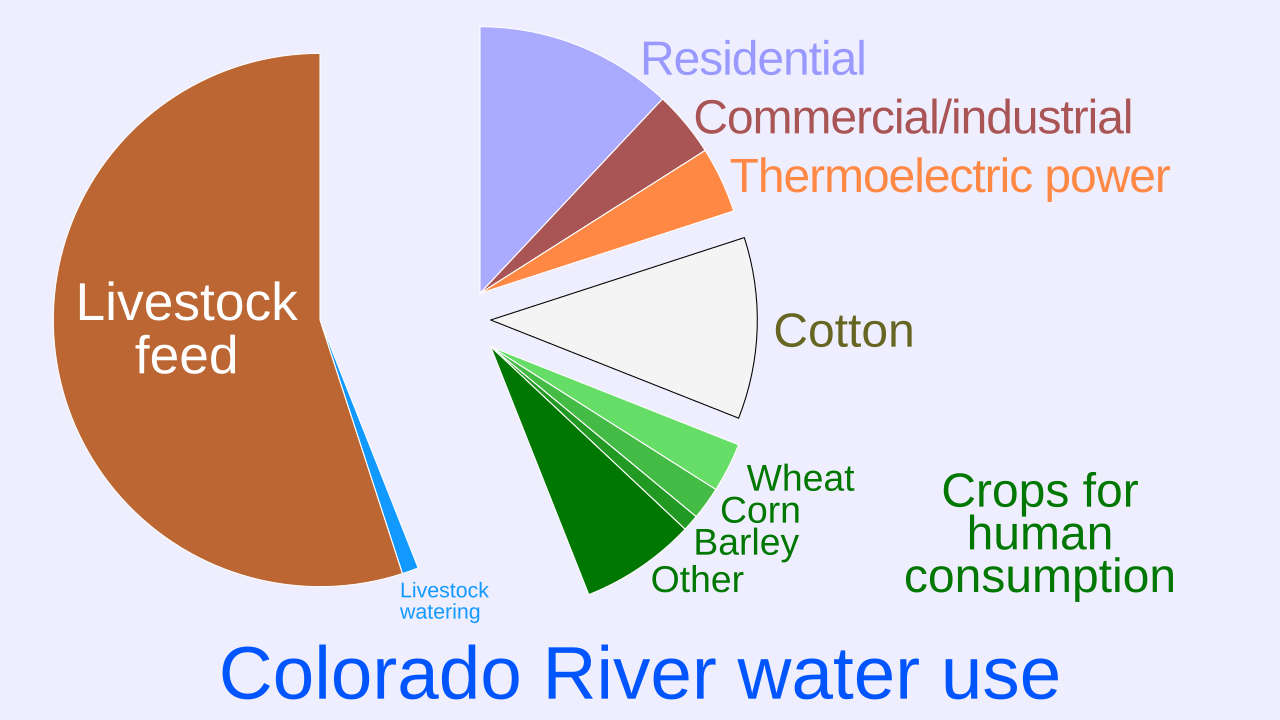
The Colorado River and its tributaries are a vital source of water for 40 million people. An extensive system of dams, reservoirs, and aqueducts divert almost its entire flow for agricultural irrigation and urban water supply. Its large flow and steep gradient are used to generate hydroelectricity, meeting peaking power demands in much of the Intermountain West. Intensive water consumption has dried up the lower 100 miles (160 km) of the river, which has rarely reached the sea since the 1960s. Large-scale river management began in the early 1900s, with major guidelines established in a series of international and US interstate treaties known as the "Law of the River". The US federal government constructed most of the major dams and aqueducts between 1910 and 1970; the largest, Hoover Dam, was completed in 1935. With all of their waters fully allocated, both the Colorado and the neighboring Rio Grande are now considered among the most controlled and litigated river systems in the world. Since 2000, extended drought has conflicted with increasing demands for Colorado River water, and the level of human development and control of the river continues to generate controversy.
Did You Know?
- The Colorado River is the 5th longest in the United States, at 1,450 miles (2,330 km).
- Its name comes from the Spanish for "colored reddish" because of its heavy silt load.
- The river has rarely reached the sea since the 1960s due to intensive water consumption.
- Hoover Dam, completed in 1935, is the largest of the major dams built by the US federal government between 1910 and 1970.
- John Wesley Powell led the first expedition to run the rapids of the Grand Canyon in the mid-19th century.
A 1,450-Mile Journey Through the Southwest
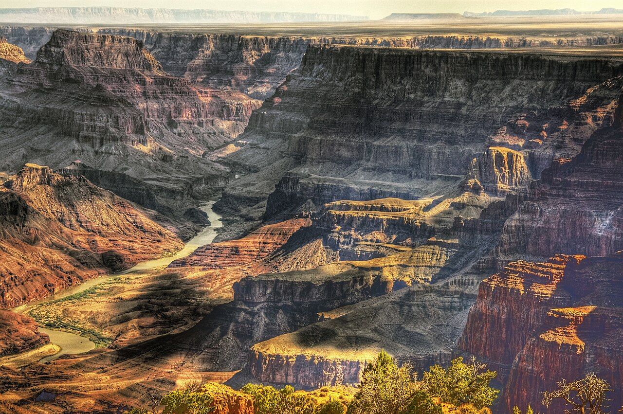
The Colorado River traces a 1,450-mile journey from the Rocky Mountains of Colorado to the tip of the Gulf of California, making it the fifth-longest river in the United States. Its name, drawn from the Spanish word for "colored reddish," reflects the heavy silt that gives the water its distinctive hue. The river's path is anything but straightforward: it begins in Rocky Mountain National Park, carves through the mountainous Western Slope of Colorado, then swings across the arid Colorado Plateau, threading through Utah's slickrock country and Arizona's deepest gorges before reaching the Arizona–Nevada border. Along the way it passes through eleven U.S. National Parks, including the Grand Canyon, and drains a watershed spanning seven American states and two Mexican states. The river's character shifts dramatically—from swift whitewater stretches 200 to 500 feet wide in the upper reaches, to the towering sandstone cliffs of "The Portal" near Moab, to the flooded Glen Canyon reach now submerged beneath Lake Powell.
Eight Millennia of Human Presence
Long before European contact, Native Americans had called the Colorado River basin home for at least eight millennia. Around the turn of the first millennium CE, large agricultural societies took root in the basin, but a convergence of prolonged drought and unsustainable land practices brought those communities down by the 1300s. Descendant groups, including the Puebloans, persisted in the region, while the Navajo arrived in the basin after the 1000s. Spanish explorers entered the picture in the 1500s, mapping and claiming the watershed, which passed to Mexico upon its 1821 independence. Even after the United States acquired most of the basin in 1846, much of the river's course remained uncharted. Mid-nineteenth-century expeditions finally brought the waterway into the public imagination—most famously John Wesley Powell's party, the first to navigate the Grand Canyon's rapids. The 1860s gold and silver strikes pulled prospectors into the upper basin, and by the late 1800s steamboats were running from the Gulf of California upriver to landings connected by wagon roads.
The Law of the River and a Web of Dams
The Colorado River is arguably the most heavily engineered waterway in the Western Hemisphere. Beginning in the early 1900s, a framework of international and interstate treaties—collectively called the "Law of the River"—set the rules for allocating its waters among seven U.S. states and two Mexican states. The U.S. federal government then built the vast majority of the major dams and aqueducts between 1910 and 1970, with Hoover Dam, completed in 1935, standing as the largest of these structures. Glen Canyon Dam, finished in the 1960s, flooded the Glen Canyon reach to create Lake Powell. Together, this network diverts nearly the entire flow of the river to serve agricultural irrigation and urban water supply for roughly 40 million people, while the river's steep gradient and volume generate hydroelectricity that meets peaking power demands across the Intermountain West. Because every drop is formally allocated, the Colorado and its neighbor the Rio Grande are now regarded as among the most controlled—and most litigated—river systems on Earth.
When the River Stops Before the Sea
The very success of the Colorado River's management system has come at a profound ecological cost. Intensive upstream consumption has dried up the lower 100 miles of the river, and since the 1960s the water has rarely made it to the sea at the Colorado River Delta, a mostly dry expanse at the tip of the Gulf of California between Baja California and Sonora. The river, once a living connection to the ocean, now often ends in dust. Compounding this, an extended drought that has persisted since 2000 has collided with steadily rising demand from the 40 million people who depend on the basin's water. The tension between human development and the river's natural state continues to generate fierce controversy. What was once a wild, silt-laden torrent carving through dramatic canyons and feeding a delta ecosystem is now a carefully metered resource, its flow dictated by treaties, dams, and courtrooms rather than by snowmelt and gravity.
Gallery
Frequently Asked Questions
Who is Colorado River?
Colorado River is a major waterway of the arid Southwest, stretching roughly 1,450 miles from its Rocky Mountain headwaters in Colorado all the way down to the Gulf of California in northern Mexico. It ranks as the fifth-longest river in the United States.
What are Colorado River's powers/role?
The river supplies drinking and agricultural water to around 40 million people across seven U.S. states and two Mexican states. Its course also carves dramatic canyons, hosts eleven U.S. National Parks, and supports a thriving whitewater-recreation scene.
How does Colorado River's story end?
After winding through the Grand Canyon and crossing vast desert stretches, the river finally pours into the Colorado River Delta at the very tip of the Gulf of California, where its freshwater meets the sea.
Why is Colorado River important?
In an otherwise water-starved region, it is the backbone of regional water security, feeding cities, farms, and ecosystems across its sprawling watershed. Landmark infrastructure like Hoover Dam (finished in 1935) and the resulting Lake Mead further cement its role in managing that scarce resource.
Who are Colorado River's closest allies?
Its principal tributaries—the Green, Gunnison, Dolores, San Juan, and Little Colorado rivers—feed into the main channel and dramatically expand the watershed it drains.
More in Rivers And Seas Of The World 1-24
Related in Rivers And Seas Of The World
Links follow this subject's own source article.
Elsewhere in the Rivers And Seas Of The World universe
Spotted an error? Know more?
This is a living reference — every entry is fact-audited, and reader corrections feed straight into our audit queue. Suggest an edit · See this site's audit record