Amu Darya
Central Asian river, ancient Oxus, boundary of Greater Iran and Turan.

via Wikipedia: Amu Darya · see source
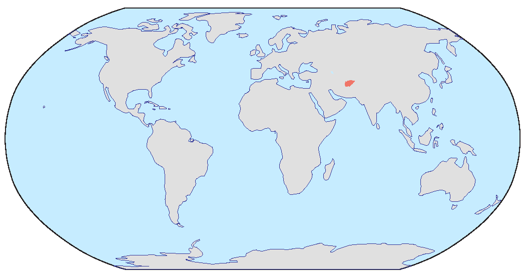
The Amu Darya, historically known as the Oxus, is a major river in Central Asia which flows through Afghanistan, Tajikistan, Turkmenistan, and Uzbekistan. Rising in the Pamir Mountains, north of the Hindu Kush, the Amu Darya is formed by the confluence of the Vakhsh and Panj rivers, in the Tigrovaya Balka Nature Reserve on the border between Afghanistan and Tajikistan. In ancient history, the river was regarded as the boundary of Greater Iran with Turan, which roughly corresponded to present-day Central Asia. The river has a flow of about 70 cubic kilometres per year on average.
- Average flow
- 70 cubic km per year
Lore & Background
The river's source has been a subject of dispute. Historically, four different claimants were proposed: the Pamir River from Lake Zorkul, the Sarhad River from the Little Pamir, Lake Chamaktin feeding the Aksu River, and an ice cave in the Wakhjir valley. In 2007, Bill Colegrave's expedition found that two claimants shared the same source, the Chelab stream, which bifurcates on the watershed of the Little Pamir. In 2025, Kate Leeming and Rupert McCowan led an expedition to determine the source of Chelab stream. Approximately 7km from where the Chelab bifurcates the team came to the confluence of its two principal contributory streams. Deciding that the West stream had the largest flow, they followed it a further 7.67km, crossing 28 contributory streams along the way to reach, on 16 August, the source of the Chelab, a glacial lake at 4951m altitude. The team named the source Lake Malang after their esteemed Afghani guide, Malang Darya. The lake is now considered the true source of not only the Chelab, but also the Amu Darya (Oxus River) because it is the head of the longest of the contributory streams, has the greatest flow, the highest altitude, and importantly, it has been assessed as a permanent geographical feature in the landscape.
Reader's Guide
The Amu Darya holds significant historical and geographical importance as a major waterway in Central Asia. It served as a natural boundary between Greater Iran and Turan in ancient times and was part of the Silk Road, with one southern route running along part of the Amu Darya northwestward from Termez before going westwards to the Caspian Sea. The river's drainage basin covers 534,739 square kilometres, including most of Tajikistan, the southwest corner of Kyrgyzstan, the northeast corner of Afghanistan, a narrow portion of eastern Turkmenistan and the western half of Uzbekistan. Its waters, derived almost entirely from glaciers in the Pamir Mountains and Tian Shan, have been heavily diverted for irrigation since the late 1950s, contributing to the shrinking of the Aral Sea. The river no longer reaches the Aral Sea and is lost in the desert. Historical records indicate that in different periods, the Amu Darya flowed into the Aral Sea (from the south), into the Caspian Sea (from the east), or both, leading to proposals by Tsarist and later Soviet engineers to divert the Amu Darya to the Caspian Sea by constructing the Transcaspian Canal. The river's watershed was home to a river valley civilization in the late 3rd millennium BCE, forgotten to history until its discovery by Soviet archaeologists in the 1970s. Its legacy includes its role in ancient empires, such as when the Mongols used the water of the Amu Darya to flood Konye-Urgench.
Did You Know?
- The Amu Darya is formed by the confluence of the Vakhsh and Panj rivers in the Tigrovaya Balka Nature Reserve on the border between Afghanistan and Tajikistan.
- In 2025, an expedition named the true source of the Amu Darya Lake Malang, after the Afghani guide Malang Darya.
- The river's drainage basin covers 534,739 square kilometres, with about 61% in Tajikistan, Uzbekistan and Turkmenistan, and 39% in Afghanistan.
- Historical records state that in different periods, the Amu Darya flowed into the Aral Sea, the Caspian Sea, or both.
- The river's watershed was home to a river valley civilization in the late 3rd millennium BCE, discovered by Soviet archaeologists in the 1970s.
Course & Geography
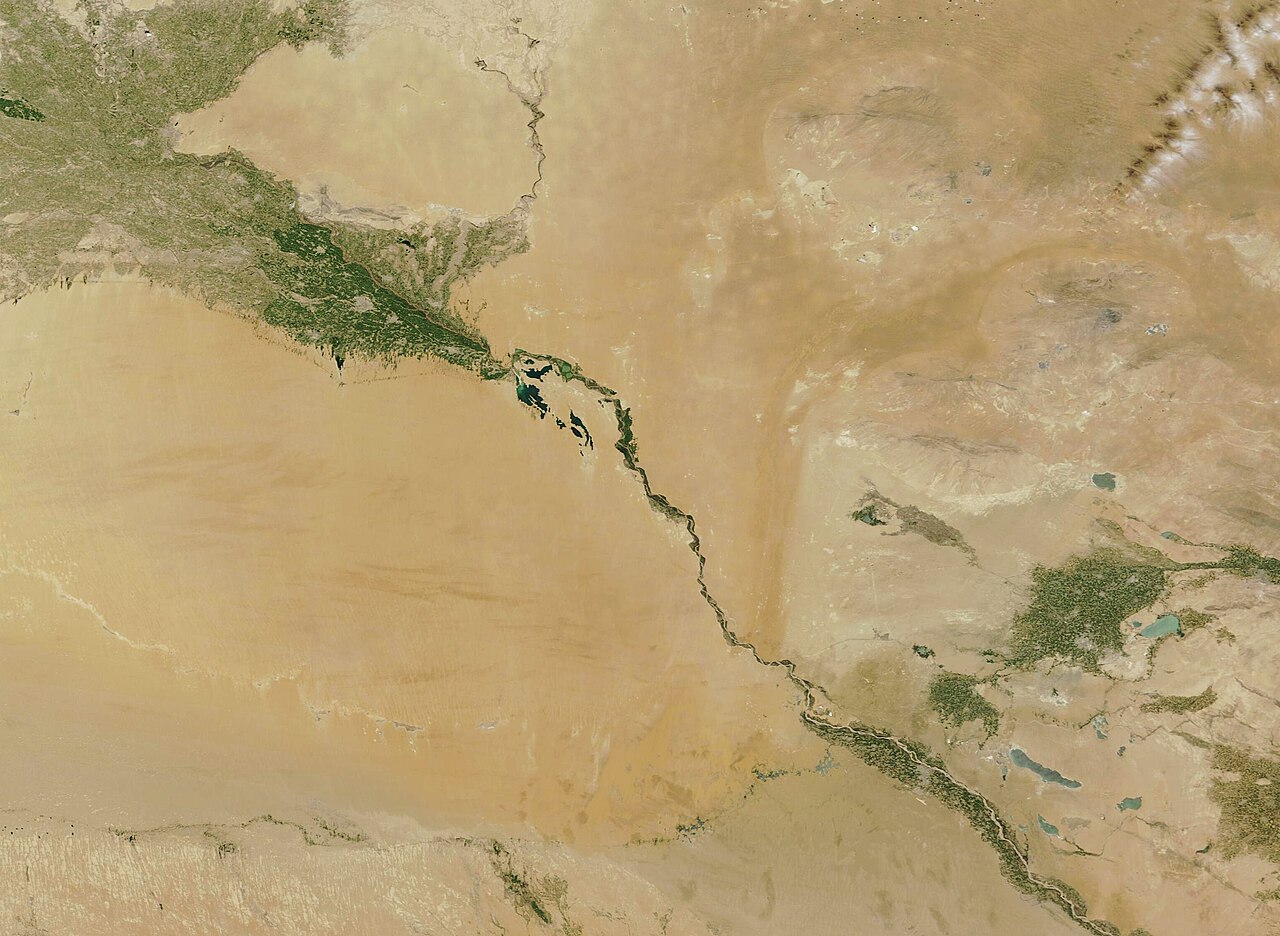
The Amu Darya stretches 2,400 kilometres across Central Asia, threading through Afghanistan, Tajikistan, Turkmenistan, and Uzbekistan. Born where the Vakhsh and Panj rivers meet in the Tigrovaya Balka Nature Reserve on the Afghan-Tajik border, it carves a northwesterly path through some of the world's most arid terrain. Its drainage basin spans 534,739 square kilometres, and the river carries roughly 97.4 cubic kilometres of water annually—nearly all fed by precipitation exceeding 1,000 millimetres in the high southern mountains. Over 1,450 kilometres of its length remain navigable. Yet the river's final chapter is one of loss: once it emptied into the Aral Sea, today its mouth terminates in a desiccated expanse of what was once that great inland body of water. Even before modern irrigation drained it, summer evaporation in the high deserts it crosses meant not all discharge reached the sea, though Pamir glacier melt once allowed the Aral to overflow in the 13th and 14th centuries.
A River of Many Names
Few rivers carry as many names as the Amu Darya, each reflecting a different civilisation's encounter with it. In classical antiquity, Greek and Latin writers called it the Oxus, a name clearly derived from Vakhsh, its largest tributary. In 19th-century Afghanistan, travellers recorded the name Gozan, which Greek, Mongol, Chinese, Persian, Jewish, and Afghan historians had all used at various points. The modern name Amu Darya itself is a Persian construction: Amu from the medieval city of Āmul (today Türkmenabat), and Daryā meaning 'lake' or 'sea.'
The Hunt for the True Source
For over a century, scholars have debated where the Amu Darya truly begins. Since the late 1800s, four candidates have been proposed: the Pamir River emerging from Lake Zorkul; the Sarhad or Little Pamir River in the High Wakhan; Lake Chamaktin feeding the Aksu-Murghab-Bartang chain; and an ice cave at the end of the Wakhjir valley near the Pakistani border. In 2007, Bill Colegrave's expedition to Wakhan revealed that the second and third claimants shared a single parent stream, the Chelab, which splits on the Little Pamir watershed—half feeding Lake Chamaktin, half feeding the Sarhad. That discovery narrowed the mystery considerably. Then in August 2025, Kate Leeming and Rupert McCowan led a team that traced the Chelab to its headwaters. Following the larger western contributory stream for 7.67 kilometres past 28 tributaries, they reached a glacial lake at 4,951 metres. Named Lake Malang after their Afghan guide Malang Darya, it is now recognised as the river's true source.
Borders, Water Politics & the Aral Crisis
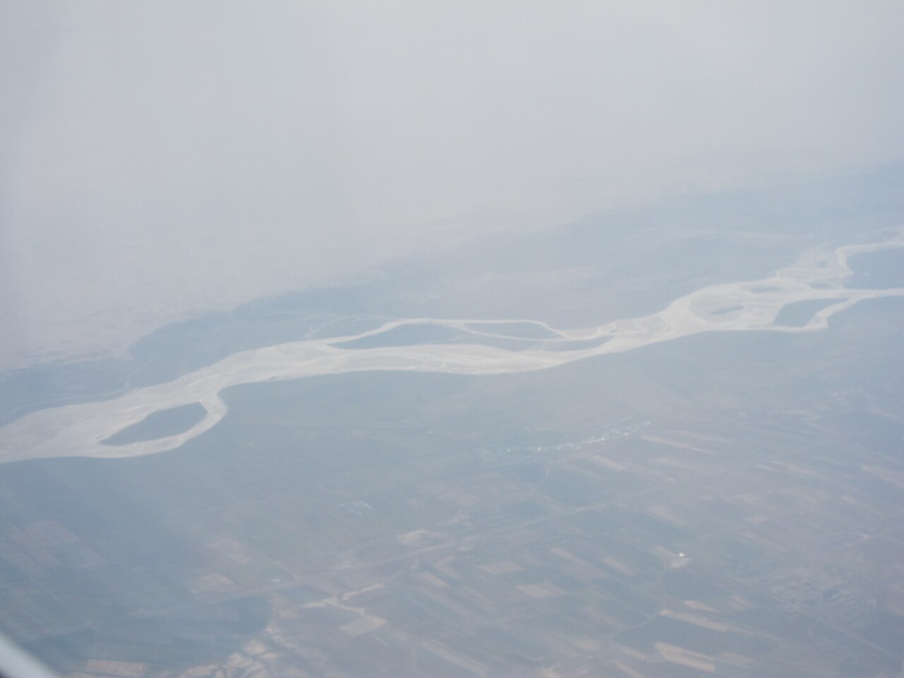
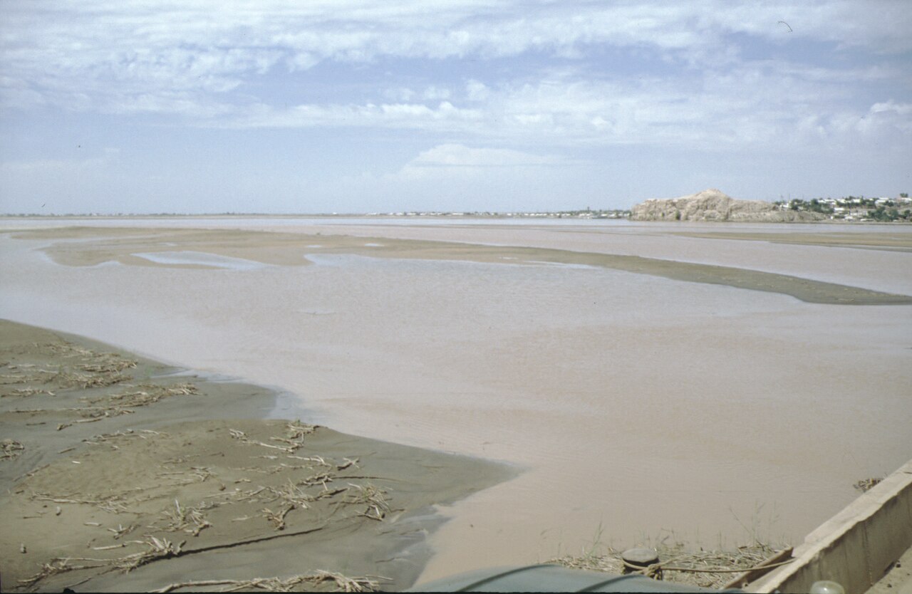
The Amu Darya has long served as a political dividing line. In ancient times it marked the boundary between Greater Iran and Turan, the vast steppe world of present-day Central Asia. Today it still draws international borders: the Panj segment separates Afghanistan from Tajikistan, then from Uzbekistan for roughly 200 kilometres past Termez, then from Turkmenistan for another 100 kilometres before entering Turkmen soil at Atamurat. The river crosses Turkmenistan south to north through Türkmenabat, forms the Turkmen-Uzbek border from Halkabat, and passes Urgench and Daşoguz. At Tuyamuyun, the Tuyamuyun Hydro Complex splits the flow into multiple channels—remnants of the delta that once fed the Aral Sea. Yet the water no longer reaches what little remains of that sea. Heavy irrigation draws have left the river's terminus stranded in dry desert, a stark testament to how human water management has reshaped one of Central Asia's defining landscapes.
Gallery
Frequently Asked Questions
Who is Amu Darya?
The Amu Darya is a major Central Asian river threading through Afghanistan, Tajikistan, Turkmenistan, and Uzbekistan. It is the same waterway the ancient Greeks called the Oxus and that medieval Islamic scholars later identified with the biblical Gihon.
Where does Amu Darya come from?
The river is born in the Pamir Mountains, just north of the Hindu Kush range. It officially takes shape at the confluence of the Vakhsh and Panj rivers, where two separate channels merge into a single flowing body.
What role did Amu Darya play in ancient history?
For centuries the river marked the dividing line between Greater Iran and the lands of Turan. That geopolitical boundary made it a recurring flashpoint in classical conflicts and a fixed reference point in ancient geography.
How much water does Amu Darya carry each year?
The river's mean discharge sits around 1,400 to 1,500 cubic meters per second, translating to roughly 44 to 47 cubic kilometers of flow over the course of a year.
Why is Amu Darya important to Central Asia?
It is one of the region's two great rivers and a lifeline for irrigation, agriculture, and the cultures of four nations. Its waters sustain oases and farmland across an otherwise arid stretch of the continent.
More in Rivers And Seas Of The World 1-24
Related in Rivers And Seas Of The World
Links follow this subject's own source article.
Elsewhere in the Rivers And Seas Of The World universe
Spotted an error? Know more?
This is a living reference — every entry is fact-audited, and reader corrections feed straight into our audit queue. Suggest an edit · See this site's audit record